 |
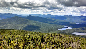
| View from the summit's fire tower, Mt Snow |
Here's a map with driving directions. Distances and directions are approximate, not exact. See the Maine Mountain Guide for more information.
View Hiking Mt Snow (Chain of Ponds Quad), ME in a larger map
As I said, the area is remote, even by Maine standards. Expect no nearby services, cell phone reception nor 3g for that matter. You do have to drive about 5 miles of dirt and logging roads to get there but they are passable by normal clearance vehicles. I had no trouble getting to the parking area.
As are most trails in this part of the state, you follow a collection of ATV trails, old logging roads and half-maintained trails to get to the summit. There are absolutely no signs, no milage markers and nothing that would help you distinguish your location should you get lost. Bring the Maine Gazetteer and the Maine Mountain Guide. A GPS would be desirable as well. If you break down out here, you're on your own.
The trail begins at the end of the parking area and you walk briefly along the old logging road until coming to a fork, less than 1000 yards from the starting area. The dirt road then wanders through the woods, essentially paralleling the Snow Pond stream until reaching the outlet. There is one section where I made a wrong turn and continued to head in a southerly direction away from the pond; I realized the error before I had wandered too far away.
 |
| Outlet of Snow Pond |
 |
| The trail and the road are mostly muddy and overgrown |
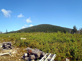
After coming to the outlet of snow pond, the logging road continues but if you keep an eye out, there's a flagged trail that leaves the road and heads into the woods. This is a very brief section that coming right back out to another logging road/ATV trail. From here, the route gains elevation before coming to the height of the land. You must be on the lookout for a faint but obvious herd path marked with a cairn that heads directly North. It is not signed nor flagged- look for the cairn on the north side of the trail. I missed it on my first pass and continued on the logging road as it began to lose elevation before coming to a clearing. The clearing had nice views as well as a great lookout of the Snow Mountain summit, but it ended abruptly. I turned back and found the trail without too much trouble.
Fortunately, from here the trail is very obvious as it takes almost a direct ascent of the summit's north side. After finding this trail, it took no time at all to ascend to the summit although it was steep in some sections.
 |
| The trail is easy to follow although it isn't marked |
 |
| Here's the clearing I popped out on which was the wrong direction. It had a good view of the summit though |
 |
| The trail is easy to miss if you aren't keeping a close eye out for it |
 |
| The view from Mt Snow's fire tower |
Climbing down wasn't too difficult, now that I knew the route. The entire hike is about 6.6 miles, round trip and can be easily accomplished in 1/2 a day or along with other summits in the area. For me, that meant taking a trip over to Mt Kibby, which also had an old fire tower with a marvelous view.
Read. Plan. Get Out There!
Good morning! For some reason I am not able to view your map. I can see the photos but not the map. If I click on the link beneath it to enlarge it, it asks me to sign into Google. Is there anyway for me to view the map? Thanks!
ReplyDeleteHello! I'm sorry to hear that it isn't working. Try this link- https://drive.google.com/open?id=1Lhm_tfEVMLDYmDINfcDJ0R4OXik&usp=sharing. Let me know if that doesn't work as well. Good luck on the hike!
Delete